Contour planning is an essential approach to land development that takes into account the natural topography and features of a landscape. By creating a blueprint for how to utilise land effectively, contour planning helps ensure that the area can reach its full potential while maintaining environmental integrity. This article will guide you through the basics of contour planning, its processes, benefits, and some common challenges that may arise.
Understanding the basics of contour planning
Before diving into contour planning, it’s important to grasp what it entails. At its core, contour planning is the practice of designing land use in a way that aligns with the natural contours of the land. This means assessing the slope and elevation changes and creating a plan that harmonises with these features.
What is contour planning?
To put it simply, contour planning is the process of mapping out land in relation to its physical characteristics, primarily its contours. It involves studying the land to create effective strategies for agriculture, construction, landscaping, and other land uses. By using contour lines, which represent elevation levels, planners can visualise how water will flow across a landscape, which is critical for numerous applications.
The importance of contour planning for land development
Contour planning plays a vital role in sustainable land development. It helps mitigate various issues related to water runoff and soil erosion. When land is developed without regard for its natural patterns, the consequences can be damaging: excess water runoff can lead to flooding, and soil can wash away, diminishing its fertility.
Furthermore, contour planning serves as a tool for maximising the usability of land. By recognising the natural slopes and contours, developers can make informed decisions on plant placement, irrigation systems, and building locations. This approach ensures that land is not only functional but also enhances the aesthetic appeal of the area.
The process of contour planning
Now that we understand the significance of contour planning, let’s explore the process itself. It involves several steps, each contributing to the creation of an effective contour plan.
Initial assessment and surveying
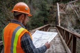
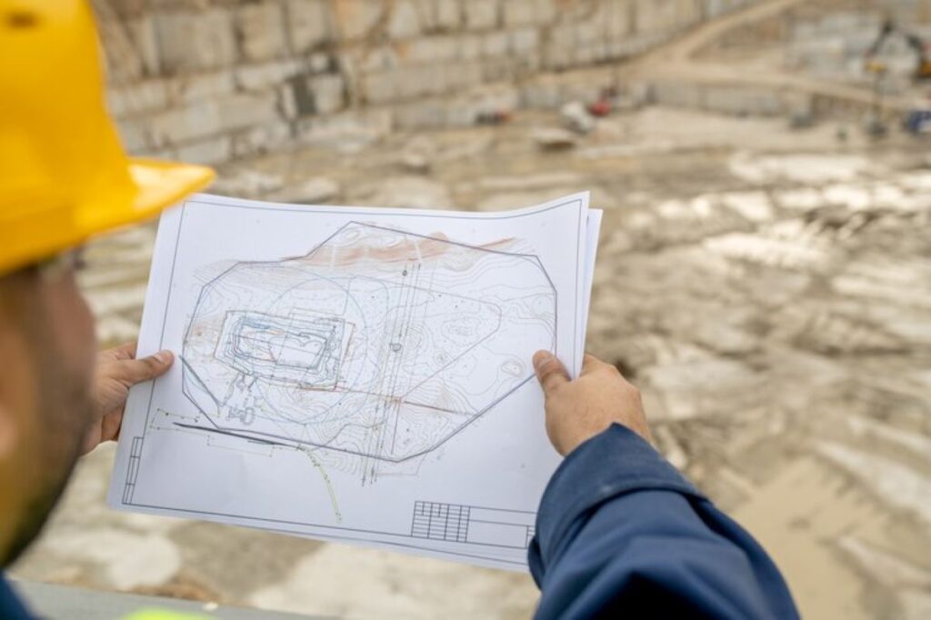
The first step in contour planning is conducting a thorough assessment of the land. This involves surveying the property to gather valuable data on elevation, slope, and existing vegetation. Professional surveyors often use tools like GPS, laser levels, and topographic maps to collect this information accurately.
In this phase, it’s also crucial to consider how water moves across the land. Observing patterns of drainage and gathering data on local climate will provide further insight into how the land can be managed effectively.
Designing the contour plan
Once the assessment is complete, the next step is designing the contour plan. This process involves creating detailed maps that illustrate the proposed land use, taking into consideration the natural contours. The design should incorporate features such as terraces, swales, and drainage channels that will work in concert with the land’s topography.
At this stage, collaboration with landscape architects and ecologists can provide added benefits. They can offer professional advice on plant selection and soil conservation practices that align with contour planning principles.
Implementing the contour plan
After finalising the design, it’s time for implementation. This phase may involve excavation and reshaping of the land to create the approved contours. Care must be taken during this process to minimise disruption to the environment.
Once the physical changes have been made, the cultivation of vegetation and installation of water management systems can follow. Monitoring these systems will ensure that they function as intended, providing the necessary water retention and absorption while enhancing the landscape’s beauty.
Benefits of contour planning
The advantages of contour planning are numerous and far-reaching. By employing these methods, landowners can enjoy a host of benefits that range from improved productivity to environmental preservation.
Enhancing land productivity
One of the key benefits of contour planning is the enhancement of land productivity. When land is developed in harmony with natural contours, agricultural practices can be optimised. This approach leads to more efficient irrigation and can even increase crop yields.
Furthermore, through careful planning, land can be used for multiple purposes, such as farming alongside recreational areas, which contributes to a higher return on investment for landowners.
Preventing soil erosion and water runoff
By integrating contour lines into the planning process, landowners can effectively reduce soil erosion and mitigate water runoff. Contour practices, such as building terraces, help slow down water flow, allowing for better absorption into the soil.
As a result, this not only preserves the topsoil but also maintains the land’s productivity and promotes a healthier ecosystem. This is particularly important in regions prone to heavy rainfall or where agriculture is practiced.
Promoting sustainable land use
Lastly, contour planning is an effective approach to promoting sustainable land use. By considering the ecological aspects during planning, landowners can create spaces that support biodiversity and conserve natural resources.
Incorporating sustainable practices within contour planning contributes to long-term environmental stability, ensuring that land remains usable for future generations.
Common challenges in contour planning
While contour planning offers significant benefits, there are challenges that may arise during the process. Being aware of these challenges can help landowners and developers plan accordingly.
Dealing with steep slopes
One of the most common difficulties in contour planning is managing steep slopes. Such terrains can complicate construction and agricultural operations, requiring more extensive planning and engineering solutions.
Additionally, steep slopes may pose risks such as soil slippage or increased runoff if not accurately assessed. Incorporating measures such as retaining walls or contour farming techniques can help address these issues effectively.

Addressing soil type variations
Soil type variations can also be a significant challenge in the contour planning process. Different types of soil behave uniquely regarding water retention, nutrient levels, and erosion susceptibility. Understanding these variations is crucial for effective planning.
Consulting with soil scientists early in the process can provide valuable insights and guide the types of crops or vegetation to be introduced, ensuring optimal land use. CheckOut more guidence about Contour Plans: Visualising Topography for Better Land Use
Managing large land areas
Finally, managing large land areas presents its own set of complexities. The vastness of the terrain can lead to difficulties in surveying and planning, along with the need for coordinated efforts across multiple sections of land.
In these cases, breaking the land into manageable units can facilitate the planning process, allowing for more focused management strategies. Employing technology and digital mapping tools may also streamline efforts and enhance accuracy.
In conclusion, contour planning serves as an effective blueprint for optimising land use potential. By understanding the basics, processes, benefits, and challenges of contour planning, landowners can make informed decisions that yield positive outcomes for both people and the environment.