In the realm of land use and environmental planning, contour plans serve as a critical tool in understanding the lay of the land. By providing a visual representation of topography, these plans enable planners, architects, and environmentalists to make informed decisions that benefit both built environments and natural ecosystems. This article explores the significance of contour plans, the science behind them, and how modern technologies are enhancing their effectiveness.
Understanding the basics of contour plans
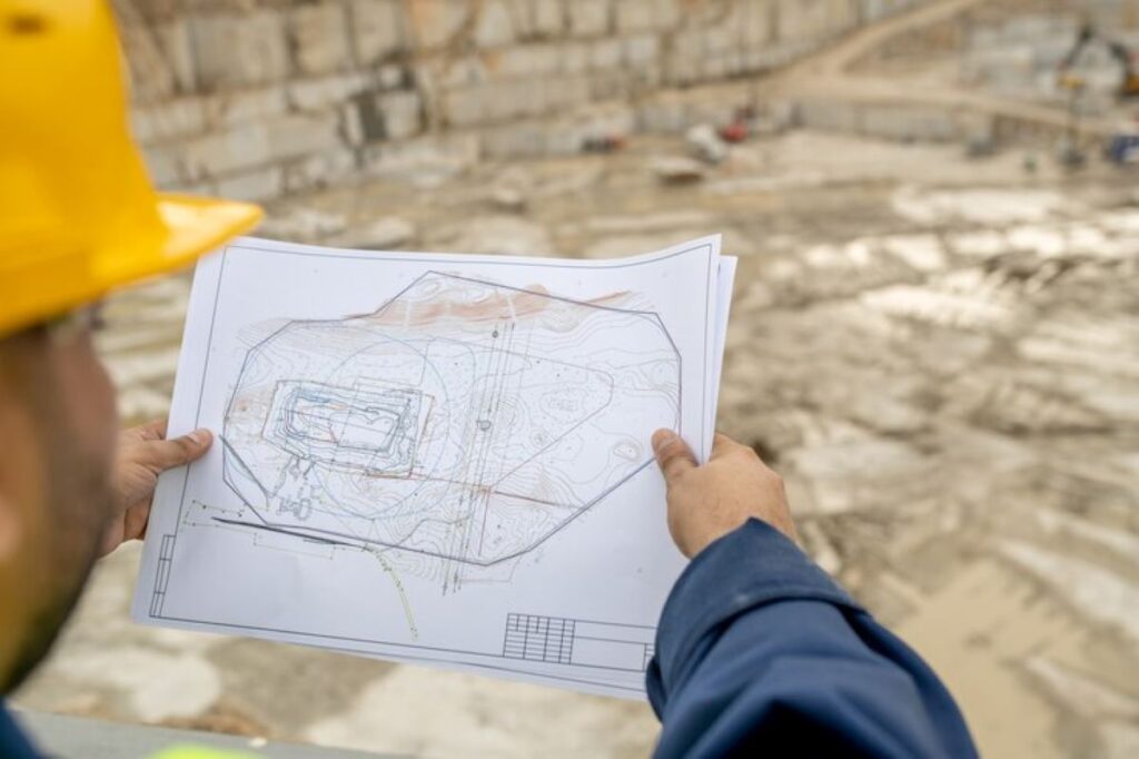
To grasp the importance of contour survey plan, it’s essential to start with a solid understanding of what they are. At their core, contour plans are two-dimensional representations of three-dimensional landscapes. By employing contour lines, which connect points of equal elevation, these plans visually depict the slopes, valleys, and peaks of an area.
But why are contour plans so vital? They play a pivotal role in land use planning by offering insights into the natural features of a landscape. With this knowledge, planners can identify areas prone to erosion, water pooling, or other environmental challenges, allowing for better decision-making in land development.
What are contour plans?
Contour plans essentially illustrate how a particular piece of land varies in elevation. Each contour line represents a specific height above sea level, and the spacing between these lines indicates the steepness of the terrain. Closer lines suggest a sharp incline or decline, while wider spacing signals a gentler slope.
These plans are commonly used in various fields, including agriculture, urban planning, and landscape architecture. They support practical applications such as determining optimal locations for buildings, roads, and other infrastructure by considering the natural landscape’s characteristics.
The importance of contour plans in land use
Contour plans are not just about aesthetics or technical drawings; they have significant practical implications for land use. By illustrating the topography, these plans enable users to assess how land can be best utilised while minimising any adverse environmental impacts.
Moreover, they facilitate communication among stakeholders, ensuring that everyone involved in a project—from architects to environmentalists—has a comprehensive understanding of the land’s topographical challenges and opportunities.
The science behind contour plans
Understanding the science of contour plans is crucial for their effective application. It’s not merely a matter of drawing lines; there’s a systematic approach that reveals much about the landscape’s configuration and its implications for land use.
How contour lines represent elevation
Contour lines are the backbone of contour plans, providing a clear graphic representation of elevation changes. Each line corresponds to a specific elevation level, and by following these lines, one can visualise the terrain’s undulations.
For instance, if you were to walk along a contour line, you would maintain the same elevation throughout your journey, making it easier to gauge the landscape’s topography without physically traversing steep hills or drops.
Interpreting contour intervals and scales
Understanding contour intervals is another fundamental aspect of reading contour plans. The contour interval is the vertical distance between contour lines. A smaller interval may indicate a more detailed representation of a steep slope, while a larger interval can suffice for gradual terrain.
Additionally, the scale of the plan provides context. A larger scale means that more detail can be represented, allowing planners to make more precise evaluations. It is crucial for a planner or user to comprehend both the scale and the contour interval to avoid misinterpretation of the data.

The role of contour plans in land use planning
Moving beyond theory, let’s discuss how contour plans impact practical land use planning. Their role cannot be overstated, for they inform critical decisions that can affect the environment and communities alike.
Identifying suitable land for construction
When it comes to construction, especially in hilly or uneven terrain, contour plans are invaluable. They help planners identify which portions of land are suitable for building and which areas may pose challenges such as landslides or flooding.
By analysing contour plans, one can make informed choices about the placement of structures in a way that aligns with the natural landscape. This adherence to topography not only enhances safety but is also essential for sustainability.
Planning for water drainage and irrigation
Water management is another critical aspect influenced by contour plans. Contour lines can indicate the natural flow of water, allowing planners to devise systems for drainage and irrigation effectively. This knowledge can help prevent waterlogging, soil erosion, and other problems that may arise with poor water management.
In agricultural applications, for example, contour farming techniques can be applied, where ploughing aligns with contour lines. This practice helps reduce soil erosion and improves water retention, showcasing how contour plans are integral to both ecological sustainability and agricultural productivity.
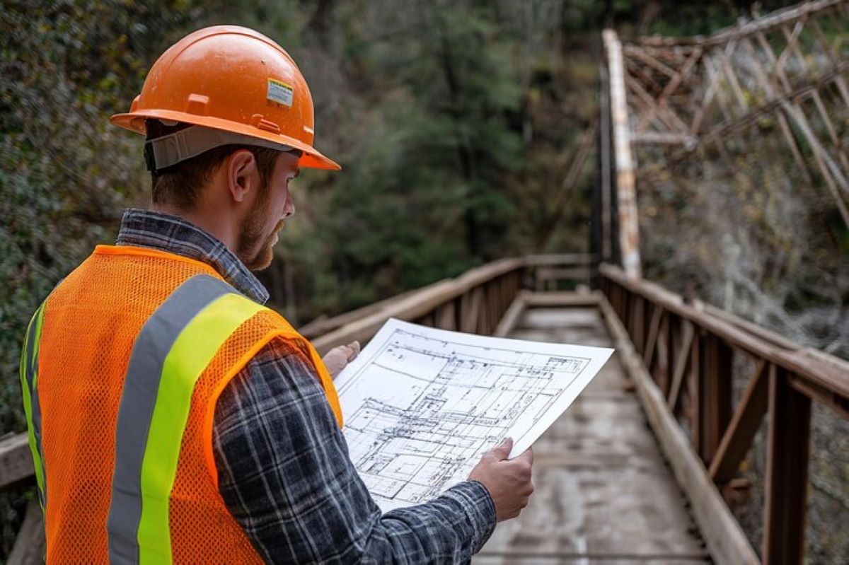
The process of creating a contour plan
Creating effective contour plans involves a systematic process that taps into various methodologies and technologies, ensuring accuracy and usability.
Gathering topographic data
The first step in creating a contour plan is gathering topographic data. This data collection can involve various methods, including traditional surveying, satellite imagery, and modern GPS technology. Each method has its unique advantages and is chosen based on the specific requirements of the project.
Once the data is collected, it needs to be accurately mapped to ensure that all elevations are captured correctly. This critical phase sets the stage for effective contour mapping.
Drawing contour lines
With accurate data in hand, the next step is to draw the contour lines. This phase requires a keen eye and understanding of how elevation changes across the landscape. The goal is to create a clear and informative representation that accurately reflects the land’s topography.
Using software tools can significantly enhance this stage, allowing for precise adjustments and visualisations that are easy to interpret. Click here to get more about Contour Planning: Creating a Blueprint for Your Land’s Potential.
Modern technologies in contour planning
In recent years, advancements in technology have revolutionised how contour plans are created and utilised. These innovations are making the process more efficient and effective than ever.
The use of GIS in contour planning
Geographic Information Systems (GIS) play a pivotal role in contour planning today. GIS allows for the integration of various data layers, providing comprehensive insights into land features, environmental factors, and human impacts. This technology enhances the ability to analyse and simulate scenarios, leading to more informed and efficient land use planning.
GIS can also assist in visualising complex data, allowing stakeholders to assess the potential impacts of development in a more accessible way, making decision-making collaborative and holistic.

The impact of drone technology on data collection
Another game-changer in contour planning is the advent of drone technology. Drones can efficiently gather high-resolution topographic data over vast areas in a fraction of the time required by traditional methods.
With drone-captured data, planners can generate highly accurate and detailed contour plans, improving the speed and precision of projects. This not only saves time but ensures that the most accurate information is at hand for effective planning and implementation of land use.
In conclusion, contour plans are invaluable tools for visualising topography and facilitating informed land use. As technology advances, the effectiveness of these plans will only continue to improve, making them essential in the quest for sustainable development.